
Forest Drones: Aerial Photogrammetry – Revolutionizing Forestry Management
Introduction
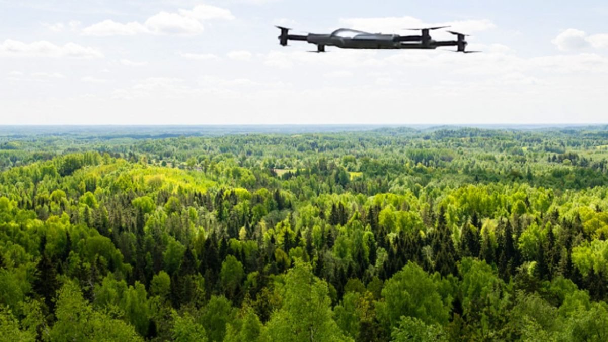
The integration of technology into forestry management has brought about significant advancements, with aerial photogrammetry using drones emerging as a game-changer. Drones, or Unmanned Aerial Vehicles (UAVs), equipped with high-resolution cameras and advanced sensors, are transforming how we monitor, analyze, and manage forest ecosystems. This article delves into the concept of aerial photogrammetry, its applications in forestry, the benefits it offers, and the challenges it faces. By the end, you’ll have a comprehensive understanding of how forest drones are revolutionizing the field of forestry.
What is Aerial Photogrammetry?
Definition
Aerial photogrammetry is the science of making measurements from photographs, particularly from aerial images. It involves capturing overlapping images of the Earth’s surface and using specialized software to create detailed 2D maps and 3D models.
How It Works
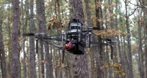
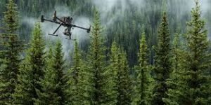
- Data Collection: Drones equipped with high-resolution cameras capture overlapping images of the forest area.
- Image Processing: Photogrammetry software processes these images to create orthomosaics (2D maps) and Digital Surface Models (DSMs).
- Analysis: The resulting maps and models are analyzed to extract valuable information about the forest, such as tree height, canopy cover, and biomass.
Key Components
- Drones: UAVs with GPS and high-resolution cameras.
- Software: Photogrammetry software like Pix4D, Agisoft Metashape, and DroneDeploy.
- Sensors: Multispectral and LiDAR sensors for advanced data collection.
Applications of Aerial Photogrammetry in Forestry
1. Forest Inventory and Monitoring
Tree Counting and Species Identification
Aerial photogrammetry allows for accurate tree counting and species identification by analyzing canopy structure and spectral signatures.
- Example: Identifying and counting oak trees in a mixed forest.
Biomass Estimation
By measuring tree height and canopy cover, photogrammetry helps estimate forest biomass, which is crucial for carbon sequestration studies.
- Example: Estimating the biomass of a pine forest to assess its carbon storage capacity.
2. Deforestation and Land Use Change
Monitoring Deforestation
Drones can capture high-resolution images of forest areas, enabling the detection of illegal logging and deforestation activities.
- Example: Monitoring deforestation in the Amazon rainforest.
Land Use Change Analysis
Aerial photogrammetry helps track changes in land use over time, providing valuable data for conservation efforts.
- Example: Analyzing the conversion of forest land to agricultural use.
3. Wildlife Habitat Assessment
Habitat Mapping
Photogrammetry creates detailed maps of forest habitats, aiding in wildlife conservation and management.
- Example: Mapping the habitat of endangered species like the orangutan.
Biodiversity Studies
By analyzing forest structure and composition, photogrammetry supports biodiversity studies and conservation planning.
- Example: Assessing the biodiversity of a tropical rainforest.
4. Disaster Management
Post-Disaster Assessment
Drones can quickly assess damage to forests after natural disasters like wildfires, hurricanes, and floods.
- Example: Evaluating the impact of a wildfire on a forest ecosystem.
Risk Assessment
Aerial photogrammetry helps identify areas at risk of natural disasters, enabling proactive management.
- Example: Identifying areas prone to landslides in a mountainous forest.
5. Silviculture and Forest Management
Growth Monitoring
Photogrammetry tracks the growth of trees and forest stands, providing data for silvicultural practices.
- Example: Monitoring the growth of a reforestation project.
Harvest Planning
Detailed maps and models assist in planning sustainable harvests and managing forest resources.
- Example: Planning the selective logging of a timber plantation.
Benefits of Using Drones for Aerial Photogrammetry in Forestry
1. High Resolution and Accuracy
Drones capture high-resolution images, providing detailed and accurate data for forest analysis.
- Example: Identifying individual trees and their health status.
2. Cost-Effectiveness
Compared to traditional methods like manned aircraft and satellite imagery, drones are more cost-effective.
- Example: Reducing the cost of forest inventory by using drones instead of helicopters.
3. Time Efficiency
Drones can cover large areas quickly, significantly reducing the time required for data collection.
- Example: Surveying a 100-hectare forest in a few hours.
4. Accessibility
Drones can access remote and difficult-to-reach areas, providing data that would be challenging to obtain otherwise.
- Example: Surveying a dense, mountainous forest.
5. Environmental Impact
Drones have a minimal environmental footprint compared to traditional methods, reducing disturbance to wildlife and ecosystems.
- Example: Conducting a forest survey without disturbing nesting birds.
Challenges and Limitations
1. Regulatory Issues
Drone operations are subject to regulations that vary by country, which can limit their use in certain areas.
- Example: Obtaining permits for drone flights in protected areas.
2. Technical Limitations
Battery Life
Limited battery life restricts the duration of drone flights, affecting the area that can be covered in a single mission.
- Example: A drone with a 30-minute flight time can only cover a limited area before needing to recharge.
Weather Conditions
Adverse weather conditions like rain, wind, and fog can hinder drone operations and affect data quality.
- Example: Postponing a drone survey due to heavy rain.
3. Data Processing
The large volume of data generated by drones requires significant processing power and expertise.
- Example: Processing thousands of high-resolution images to create a 3D model.
4. Cost of Equipment
While drones are cost-effective compared to traditional methods, the initial investment in equipment and software can be high.
- Example: Purchasing a high-end drone and photogrammetry software.
Case Studies: Real-World Applications
1. Monitoring Deforestation in the Amazon
Objective
To monitor and combat illegal deforestation activities in the Amazon rainforest.
Methodology
- Data Collection: Drones equipped with high-resolution cameras captured images of deforested areas.
- Image Processing: Photogrammetry software created detailed maps and 3D models.
- Analysis: The data was used to identify illegal logging activities and plan conservation efforts.
Results
- Improved Monitoring: Enhanced ability to detect and respond to deforestation.
- Conservation Planning: Data supported the creation of protected areas and conservation strategies.
2. Assessing Post-Wildfire Damage in California
Objective
To assess the impact of a wildfire on a forest ecosystem and plan recovery efforts.
Methodology
- Data Collection: Drones captured images of the burned area.
- Image Processing: Photogrammetry software created detailed maps and 3D models.
- Analysis: The data was used to assess damage, identify areas for reforestation, and plan recovery efforts.
Results
- Damage Assessment: Detailed maps provided insights into the extent of the damage.
- Recovery Planning: Data supported the planning of reforestation and habitat restoration projects.
3. Biodiversity Study in a Tropical Rainforest
Objective
To assess the biodiversity of a tropical rainforest and support conservation efforts.
Methodology
- Data Collection: Drones equipped with multispectral sensors captured images of the forest canopy.
- Image Processing: Photogrammetry software created detailed maps and 3D models.
- Analysis: The data was used to assess forest structure, identify species, and plan conservation strategies.
Results
- Biodiversity Assessment: Detailed maps provided insights into species distribution and habitat quality.
- Conservation Planning: Data supported the creation of conservation areas and management plans.
Future Trends in Forest Drones and Aerial Photogrammetry
1. Advancements in Sensor Technology
Multispectral and Hyperspectral Sensors
These sensors provide more detailed spectral information, enabling better species identification and health assessment.
- Example: Using hyperspectral sensors to detect early signs of disease in trees.
LiDAR Integration
LiDAR sensors provide precise 3D data, enhancing the accuracy of forest models.
- Example: Creating detailed 3D models of forest structure for biomass estimation.
2. Artificial Intelligence and Machine Learning
Automated Analysis
AI and machine learning algorithms can automate the analysis of aerial images, reducing the need for manual intervention.
- Example: Automatically identifying and counting trees in a forest.
Predictive Modeling
AI can be used to create predictive models for forest growth, health, and risk assessment.
- Example: Predicting the impact of climate change on forest ecosystems.
3. Increased Accessibility and Affordability
Consumer-Grade Drones
Advances in drone technology are making high-quality drones more accessible and affordable.
- Example: Using consumer-grade drones for small-scale forest surveys.
Open-Source Software
The development of open-source photogrammetry software is reducing costs and increasing accessibility.
- Example: Using open-source software like OpenDroneMap for forest analysis.
Conclusion
Aerial photogrammetry using drones is revolutionizing forestry management by providing high-resolution, accurate, and cost-effective data. From forest inventory and monitoring to disaster management and biodiversity studies, the applications are vast and impactful. While challenges like regulatory issues and technical limitations exist, advancements in technology and methodology are continually improving the effectiveness of forest drones. As we move forward, the integration of advanced sensors, AI, and machine learning will further enhance the capabilities of aerial photogrammetry, making it an indispensable tool for sustainable forest management. By embracing this technology, we can better understand, protect, and manage our forest ecosystems for future generations.
Leave a Reply